Caroline Island (Caroline)
Caroline Island (also known as Caroline Atoll or Millennium Island) is the easternmost of several uninhabited coral atolls comprising the southern Line Islands in the central Pacific Ocean nation of Kiribati.
The atoll was first sighted by Europeans in 1606 and was claimed by the United Kingdom of Great Britain and Ireland in 1868. It has been part of the Republic of Kiribati since the island nation's independence in 1979. Caroline Island has remained relatively untouched and is one of the world's most pristine tropical islands, despite guano mining, copra (coconut meat) harvesting, and human habitation in the 19th and 20th centuries. It is home to one of the world's largest populations of the coconut crab and is an important breeding site for seabirds, most notably the sooty tern.
The atoll is known as the first place on Earth to see sunrise each day during much of the year, and for its role in the millennium celebrations of 2000. A 1995 realignment of the International Date Line made Caroline Island the first point of land on Earth to reach 1 January 2000 on the calendar.
Map - Caroline Island (Caroline)
Map


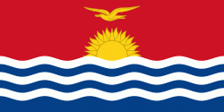
Country - Kiribati
 |
 |
| Flag of Kiribati | |
The islands' spread straddles the equator and the 180th meridian, although the International Date Line goes around Kiribati and swings far to the east, almost reaching 150°W. This brings Kiribati's easternmost islands, the southern Line Islands south of Hawaii, into the same day as the Gilbert Islands and places them in the most advanced time zone on Earth: UTC+14.
Currency / Language
| ISO | Currency | Symbol | Significant figures |
|---|---|---|---|
| AUD | Australian dollar | $ | 2 |
| ISO | Language |
|---|---|
| EN | English language |